Megaquake in the Making? The Expected Nankai Trough Earthquake
Disaster History- English
- 日本語
- 简体字
- 繁體字
- Français
- Español
- العربية
- Русский
The Restless Earth off the Southern Coast
At 4:42 in the afternoon on August 8, a magnitude 7.1 earthquake centered under the Hyūganada Sea off of the coast of Miyazaki Prefecture rattled Kyūshū, bringing shaking of lower 6 seismic intensity to the city of Nichinan.
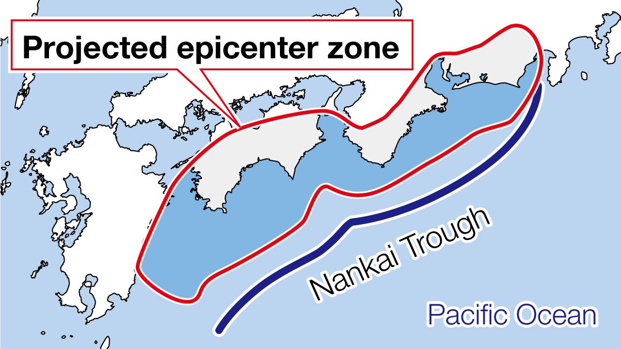
The quake, triggered at a depth of 31 kilometers below the earth’s surface, drew attention from seismologists at the Japan Meteorological Agency, who held a special meeting and judged it a potential sign of a massive earthquake along the Nankai Trough running below the sea south of Shikoku and western Honshū. That day, the JMA issued its first ever megaquake alert, urging heightened precautions against a possible temblor along the major fault line.
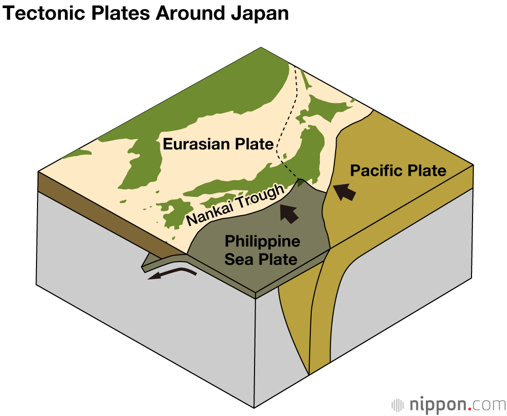
The Nankai Trough runs from Shizuoka Prefecture’s Suruga Bay in the northeast to the Hyūganada Sea in the southwest, marking the line where the Philippine Sea Plate is subducted under the Eurasian Plate. During recorded history, it has been the location of major quakes every 100 to 150 years on average. Around eight decades have passed since the last significant shakes here, the Tōnankai Earthquake of 1944 (magnitude 7.9) and the Nankai Earthquake of 1946 (magnitude 8.0), and the Japanese authorities see a 70%–80% likelihood of another quake of similar magnitude within the next 30 years. The government’s Central Disaster Prevention Council in 2019 released projections that in a worst-case scenario there could be more than 230,000 dead or missing from such an earthquake and ensuing tsunami, along with nearly 2.1 million completely destroyed or burned structures in the affected region.
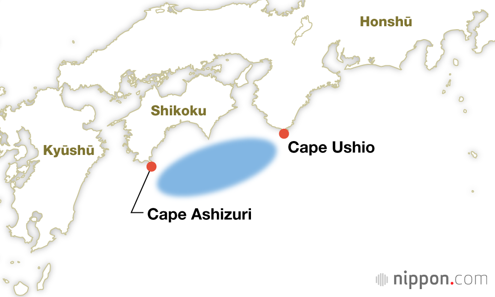
Hakuhō Earthquake (Nov. 29, 684; M8.3)
Epicenter: Offshore from Cape Ashizuri (in today’s Kōchi Prefecture) to Cape Ushio (Wakayama).
Damage: Extant records tell of landslides and overflowing rivers; the destruction of numerous official buildings, temples, and shrines; deaths of a number of humans and livestock; and a tsunami that sank many vessels in the province of Tosa (Kōchi).
Ninna Earthquake (Aug. 26, 887; M8.3)
Epicenter: Offshore from Cape Ashizuri (Kōchi) to Cape Omae (Shizuoka).
Damage: Records remain of many killed in collapsing government buildings and residences in Kyoto, and tsunami striking the coastline caused numerous deaths.

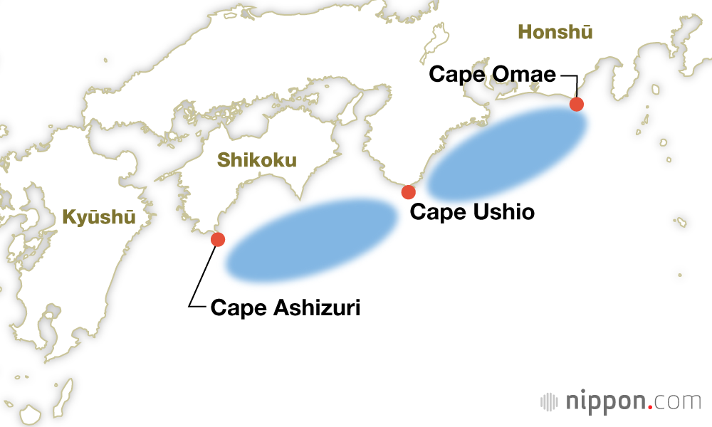
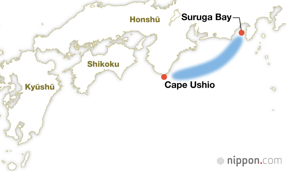
Eichō Tōkai Earthquake (Dec. 17, 1096; M8.0–M8.5) and Kōwa Nankai Earthquake (Feb. 22, 1099; M8.0–M8.3)
Epicenters: The first quake struck offshore from Cape Ushio (Wakayama) to Cape Omae (Shizuoka); just over two years later, a second struck to the southwest, from Cape Ashizuri (Kōchi) to Cape Ushio.
Damage: In Nara, the 1096 shaking caused the massive bell at the temple Tōdaiji to fall and collapsed the corridors of the temple Yakushiji; tsunami smashed into Ise and Suruga Bays. The 1099 quake destroyed the great gate and corridors of Nara’s temple Kōfukuji.
Shōhei Nankai Earthquake (Aug. 3, 1361; M8.0–M8.5)
Epicenter: Offshore in the region from Cape Ashizuri (Kōchi) to Cape Omae (Shizuoka).
Damage: Extensive damage was recorded in Settsu (Osaka to Hyōgo), Awa (Tokushima), and Tosa (Kōchi); the golden pavilion at Settsu’s temple Shitennōji collapsed.
Meiō Tōkai Earthquake (Sep. 20, 1498; M8.2–M8.4)
Epicenter: Offshore in the region from Cape Ushio (Wakayama) to Suruga Bay (Shizuoka).
Damage: Severe shaking was recorded from Kii (Mie and Wakayama) to Bōsō (Chiba), as well as inland in Kai (Yamanashi). The main hall collapsed at the grand shrine of Kumano Hongū (Wakayama) and tsunami struck along the coast as far east as Bōsō, taking many lives.
Keichō Earthquake (Feb. 3, 1605; M7.9)
Epicenter: Offshore in the region from Cape Ashizuri (Kōchi) to Cape Omae (Shizuoka).
Damage: Only minor damage was reported due to shaking, but tsunami struck along much of the Pacific coast, from Cape Inubō (Chiba) to Kyūshū. In Awa Tomoura (now the town of Kaiyō, Tokushima) the tsunami reached a height of 30 meters.
Hōei Earthquake (Oct. 28, 1707; M8.6)
Epicenter: Offshore from the Enshūnada Sea (Aichi) to Kōchi.
Damage: Collapsed homes were reported all along the Pacific coast from Suruga (Shizuoka) to Kyūshū, as well as deep inland in western Kai (Yamanashi), Shinano (Nagano), Mino (Gifu), and Toyama. Tsunami damage occurred from the Izu Peninsula (Shizuoka) to parts of Kyūshū.
Possible connections have been drawn between this quake and the magnitude 8.1 Genroku Earthquake of 1703 centered just south of Chiba, as well as an eruption of Mount Fuji on December 16, 1707, just months later.

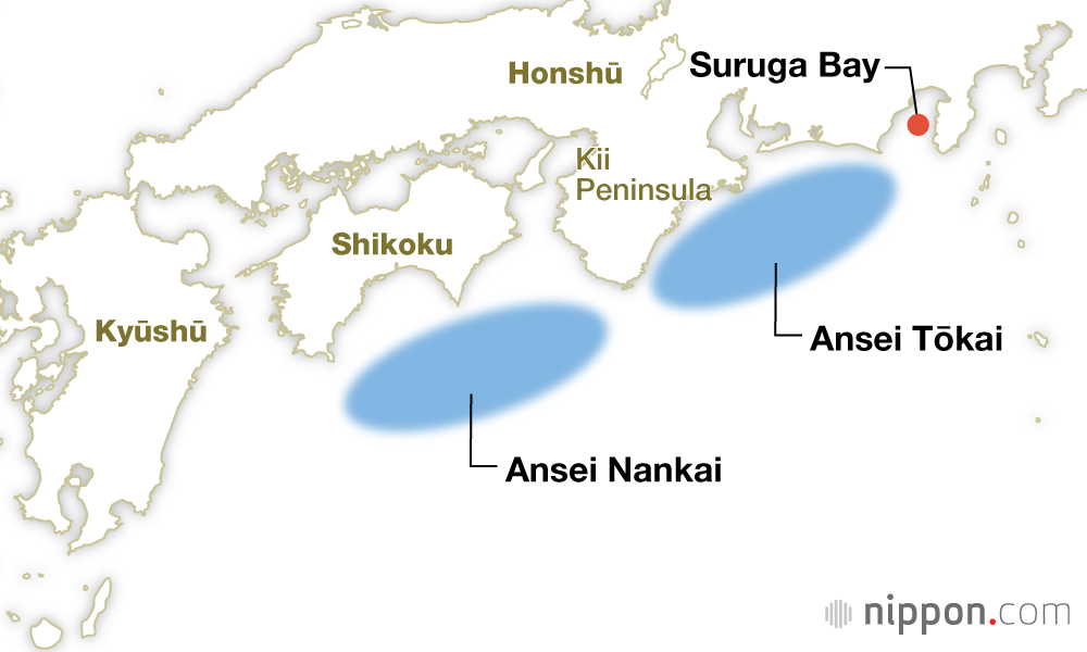
Ansei Tōkai Earthquake (Dec. 23, 1854; M8.4) and Ansei Nankai Earthquake (Dec. 24, 1854; M8.4)
Epicenters: Just 30 hours apart, the first quake struck offshore from the Kii Peninsula to Suruga Bay, while the second was triggered along the fault to the west, offshore from the Kii Peninsula to Shikoku.
Damage: The most extensive damage was reported in the area around the mouth of the Tenryū River (in today’s Hamamatsu, Shizuoka) and damage occurred in inland cities like Kōfu (Yamanashi), Matsumoto (Nagano), and Fukui. Tsunami struck from Bōsō (Chiba) to Tosa (Kōchi).
Shōwa Tōnankai Earthquake (Dec. 7, 1944; M7.9) and Shōwa Nankai Earthquake (Dec. 21, 1946; M8.0)
Epicenters: The first quake of the pair struck offshore from the Kii Peninsula to the Enshūnada Sea; two years later, the second hit the fault to the west, offshore from the Kii Peninsula along the Shikoku coast.
Damage: The 1944 earthquake dealt severe damage to Shizuoka, Aichi, Gifu, and Mie Prefectures. The 1946 temblor triggered tsunami that struck shorelines from Chiba’s Bōsō Peninsula to Kyūshū.

(Originally published in Japanese. Banner image © Kyōdō; edited by Nippon.com.)