Gust Factor: Japan’s September Typhoons Pack a Windy Punch
Environment Disaster Economy Lifestyle- English
- 日本語
- 简体字
- 繁體字
- Français
- Español
- العربية
- Русский
August is the peak of typhoon season in Japan, but the windiest storms typically arrive in September. Meteorologists classify the intensity of tropical cyclones by the average maximum sustained winds over a 10-minute period. However, the tempests also bring maximum gusts, which the Japan Meteorological Agency defines as the average wind speed during a 3-second interval, that can be many times more powerful.
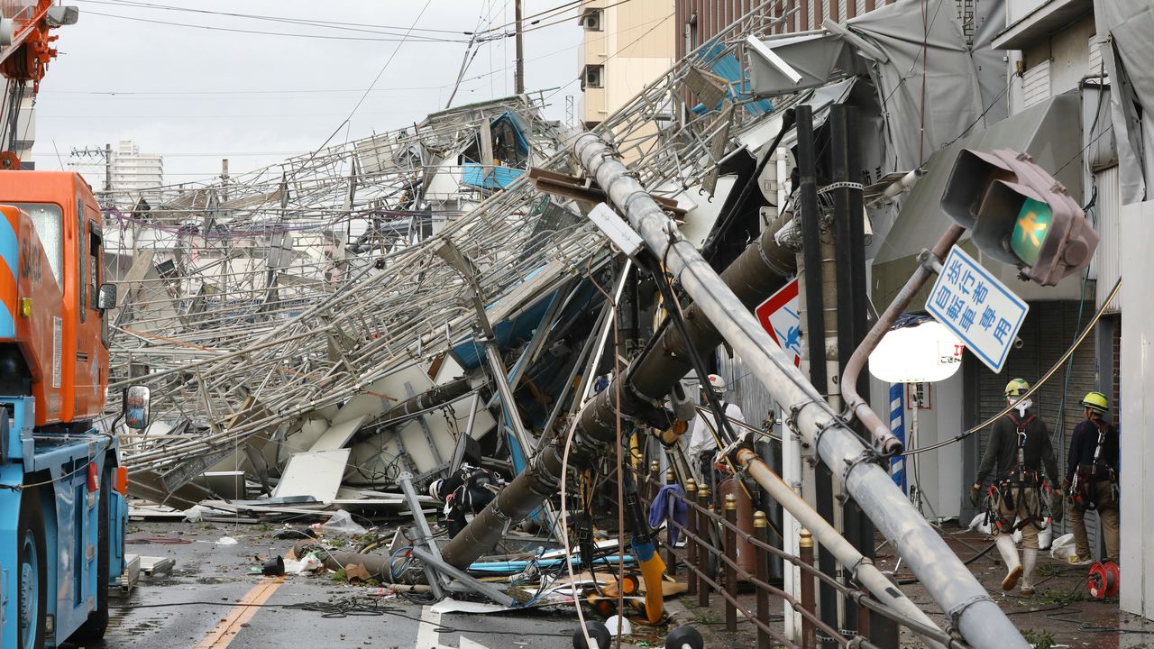
Japanese weather reports outline the zone around the eye of a storm with sustained winds exceeding 25 m/s to identify for the public the most powerful area of a typhoon. Even at the low end of the demarcation, winds can easily topple shop signs, send ceramic roof tiles flying, and overturn aluminum sheds. Storms become increasingly hazardous as wind speeds rise, with gales above 30 m/s having the force to uproot trees, snap utility poles, and tip trucks over, and gusts exceeding 40 m/s possessing the power to seriously damage or even destroy buildings.
Strongest Maximum Gust of a Typhoon
| Location | Winds m/s | Date |
|---|---|---|
| Mount Fuji, Shizuoka | 91.0 | September 25, 1966 |
| Miyako Island, Okinawa | 85.3 | September 5, 1966 |
| Cape Muroto, Kōchi | 84.5 | September 16, 1961 |
| Yonaguni Island, Okinawa | 81.1 | September 28, 2015 |
| Naze, Kagoshima | 78.9 | August 13, 1970 |
| Naha, Okinawa | 73.6 | September 8, 1956 |
| Uwajima, Ehime | 72.3 | September 25, 1964 |
| Ishigaki Island, Okinawa | 71.0 | August 23, 2015 |
| Iriomote Island, Okinawa | 69.9 | September 16, 2006 |
| Mount Tsurugi, Tokushima | 69.0 | August 21, 1970 |
Created by Nippon.com based on Japan Meteorological Agency data.
Strongest Recorded Sustained Winds
| Location | Winds m/s | Date |
|---|---|---|
| Mount Fuji, Shizuoka | 72.5 | April 5, 1942 |
| Cape Muroto, Kōchi | 69.8 | September 10, 1965 |
| Miyako Island, Okinawa | 60.8 | September 5, 1966 |
| Mount Unzen, Nagasaki | 60.0 | August 27, 1942 |
| Mount Ibuki, Shiga | 56.7 | September 16, 1961 |
| Mount Tsurugi, Tokushima | 55.0 | January 7, 2001 |
| Yonaguni Island, Okinawa | 54.6 | September 28, 2015 |
| Ishigaki Island, Okinawa | 53.0 | July 31, 1977 |
| Yakushima, Kagoshima | 50.2 | September 24, 1964 |
| Suttsu, Hokkaidō | 49.8 | April 15, 1952 |
Created by Nippon.com based on Japan Meteorological Agency data.
(Originally published in Japanese. Banner photo: Utility poles and construction scaffolding blown down by Typhoon Jebi in September 2018. © Jiji.)
